Heights Grand Loop Linear Park
Project
Year
2024
Location
Vancouver, Washington
Client
City of Vancouver, Washington

The Challenge
Design a Neighborhood Street that is Radically Equitable & Inclusive
In the summer of 2023, First Forty Feet was commissioned by the City of Vancouver to create a concept for a neighborhood street in the Heights District (The Heights). The project aimed to showcase how the broader vision for the Heights—a truly equitable and inclusive community—could be realized through its infrastructure. Drawing from key principles of the district, the team focused on fostering connection and accessibility for people of all economic and physical abilities. The plan emphasized the creation of gathering spaces, improved mobility and wayfinding, play areas, and interactive learning features. The themes of "play" and "connection to the natural environment" became central inspirations in shaping the design.

Play as a concept.
Shaped by the -ologies...

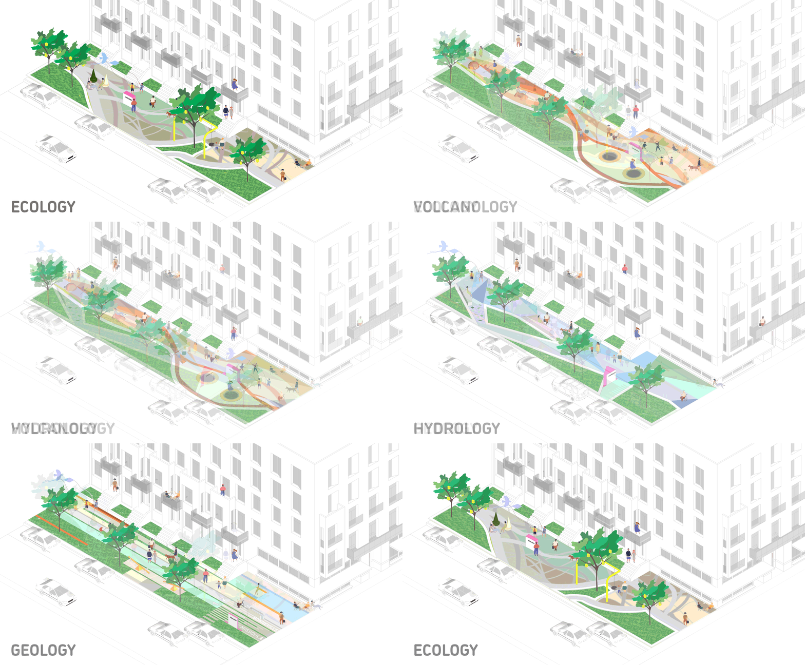
Each leg of the loop tells a story about the forces behind and the shaping of the natural environment of The Heights and Vancouver across time. The zones related to each -ology help with wayfinding, environmental graphics and brand— each with a distinctive visual aesthetic in terms of both shape and color. The zones correspond with local ecosystems and the -ologies: hydrology, ecology, geology, and volcanology.


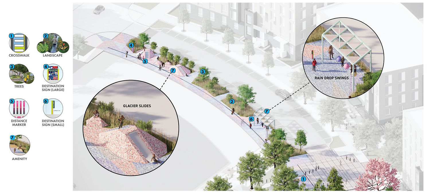
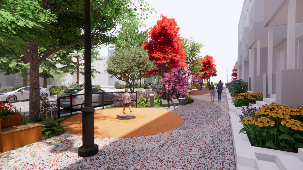
The design includes colorful paving, fun and interactive play and learning amenities, along with native vegetation to create a unique environment that's free for all people to enjoy.

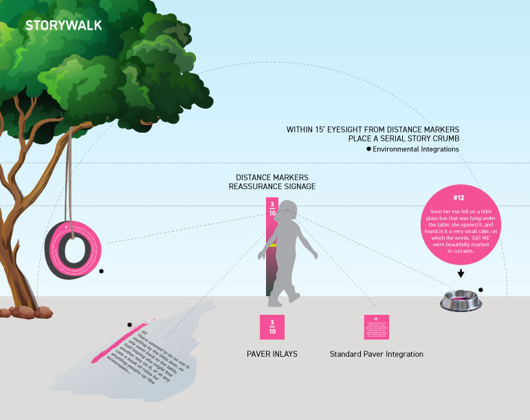
The Story Walk brings the region's natural formations to life through fictional narratives, appealing to residents who engage and learn best through imaginative storytelling rather than factual prose.

The Impact
Raising Expectations of What City Streets Can Be Like
This project will elevate expectations of what neighborhood streets can be by demonstrating how thoughtfully designed infrastructure can foster a more inclusive, connected, and vibrant community. By integrating gathering spaces, enhanced mobility, and interactive elements, the design goes beyond functionality to create spaces that encourage social interaction, active play, and learning. The emphasis on "play" and connection to nature not only promotes physical and mental well-being but also inspires a reimagining of the role streets can play in daily life, transforming them into dynamic spaces where people of all backgrounds and abilities can come together. This approach sets a new standard for streets as places for connection, creativity, and community-building, challenging traditional views of what urban streetscapes can achieve.


Get in touch
Want to know more about this project?
a better city exists
CERTIFICATIONS
Emerging Small Business (ESB)
Certification No.: 13469


.jpg)


